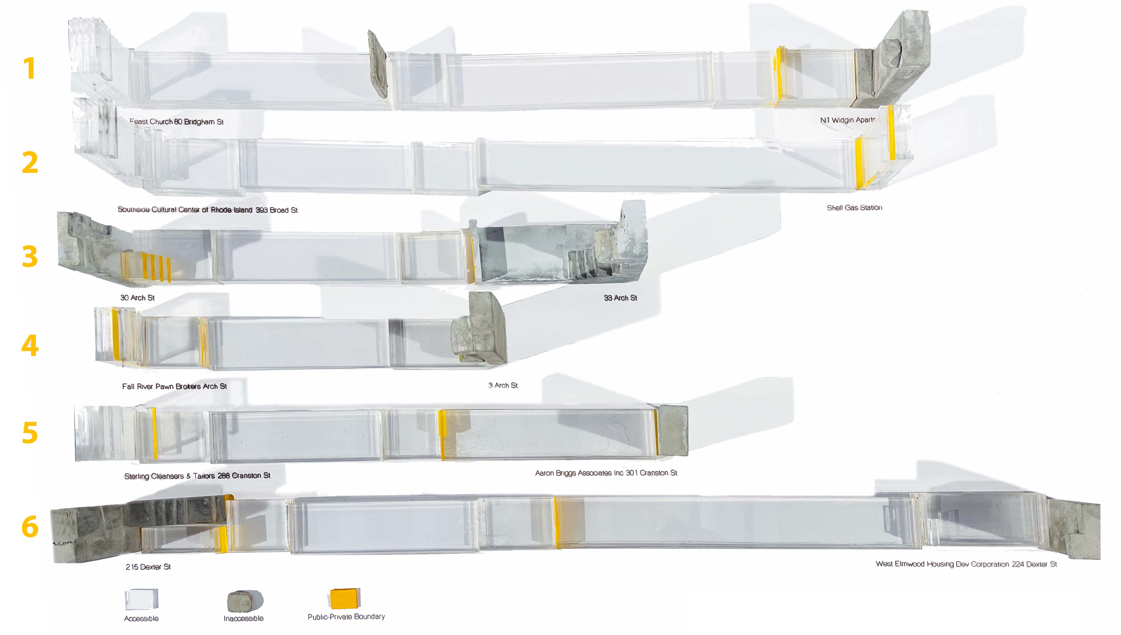

This analytical model examines urban accessibility in West End, Providence, RI, evaluating street architecture with a pedestrian-centric perspective. Disregarding property ownership, it envisions a cityscape emphasizing walkability, showcasing varied building typologies and entrance conditions. Transparent materials delineate accessible areas, while yellow highlights the public-private boundary, promoting universal use for road and transport delineations.
Details
Architectural Design & Fabrication
Date
Site
West Side, Providence, Rhode Island, 02903
Credits
Architectural Design & Fabrication
Date
2021
Site
West Side, Providence, Rhode Island, 02903
Credits
Letisya Polat
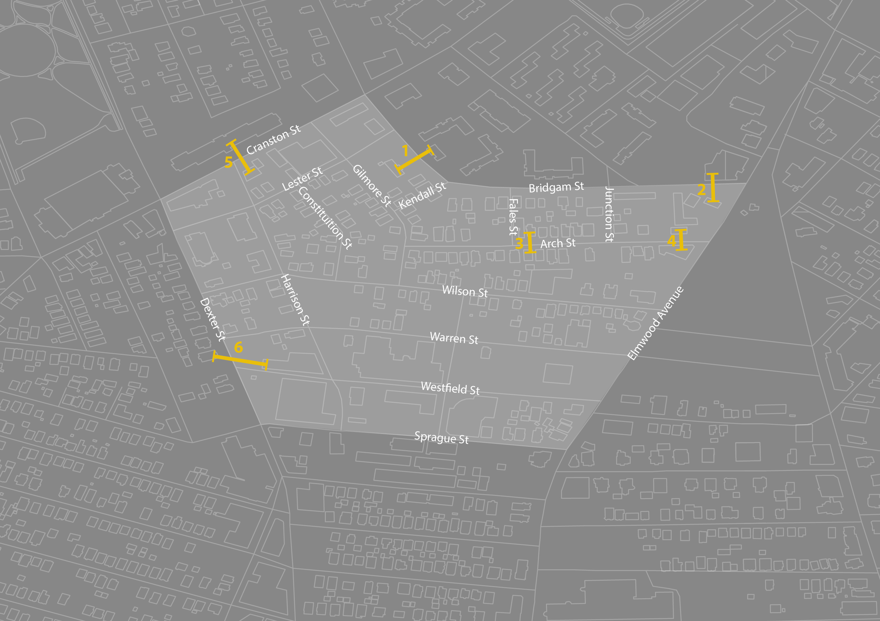
Urban Context in West End, Providence
![]()
![]()